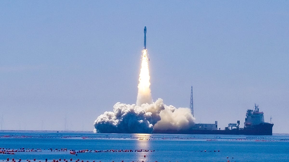
An artificial intelligence module developed by Uzbek engineers has reached orbit aboard a Chinese hyperspectral Earth observation satellite, marking a milestone for Central Asia's growing space ambitions. The satellite, named Samarkand-2028, lifted off on 5 August from a sea-based launch platform near Haiyang in China's Shandong Province.
The mission is a joint project between China's STAR.VISION and Uzbekistan's national space agency, Uzcosmos. It represents the first time an AI module built by Uzbek engineers has been deployed on one of STAR.VISION's international satellite missions.
The satellite's name carries symbolic weight. Uzbekistan's Minister of Digital Technologies, Sherzod Shermatov, explained on social media: "The name Samarkand-2028 is no coincidence. Samarkand earned the right to host the 2028 International Astronautical Congress, marking the first time the world's largest space congress will be held in Central Asia."
Onboard intelligence reduces data load
Samarkand-2028 is equipped with a hyperspectral imager, which records data across many narrow bands of the electromagnetic spectrum. Unlike conventional optical satellites, this allows it to detect subtle variations in vegetation, soil, and water that are invisible to standard cameras.
The AI module processes part of the imagery while still in orbit, analysing the data before transmission rather than sending all raw information to ground stations. According to Uzcosmos, this cuts the volume of data that must be downlinked while improving the speed and efficiency of image analysis.
"This enables faster results, reduces the volume of data that needs to be transmitted, and makes analysis on the ground more efficient," Shermatov wrote.
In effect, the satellite is not just an imaging platform but also a data-processing unit, delivering more readily usable information to analysts on Earth. This approach is becoming increasingly important as satellite operators grapple with the sheer volume of data generated by modern Earth observation missions.
Practical applications from space
Hyperspectral imaging has a wide range of uses. In agriculture, it can identify crop stress before visible symptoms appear, allowing farmers to intervene early. Environmental agencies can monitor land degradation, water quality, and ecosystem changes with greater precision. The technology also supports natural resource assessment, disaster response, and urban planning.
By processing data in orbit, the satellite reduces the burden on communication systems and ground infrastructure, which are often bottlenecks in Earth observation. Only the most relevant information is transmitted, cutting bandwidth requirements and shortening the time between image capture and analysis.
The launch follows a strategic cooperation agreement signed by Uzcosmos and STAR.VISION in 2025 to develop Earth observation technologies and expand collaboration in satellite development. For Uzbekistan, the project is part of a broader push to modernise its economy and build technological expertise, as seen in the country's decade of reforms.
The development also highlights the growing role of AI in space, a trend that European institutions are watching closely. The European Union, for instance, has recently launched a tender for seven AI gigafactories to bolster its digital sovereignty, a sign of how seriously the continent takes AI innovation.
For Uzbekistan, the successful deployment of its AI module is a point of pride and a stepping stone towards greater participation in the global space economy. As the country prepares to host the International Astronautical Congress in 2028, it is positioning itself as a regional hub for space technology and innovation.