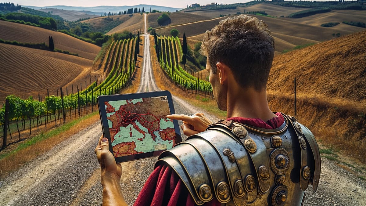
A Dutch engineer has developed a digital tool that reconstructs the Roman Empire's road network, allowing users to explore ancient routes and estimate travel times between cities as they existed 2,000 years ago. The project, called OmnesViae, is accessible through any web browser, including on mobile phones, and offers a unique window into the logistics of one of history's most expansive empires.
OmnesViae (available at Omnesviae.org) is primarily based on the Tabula Peutingeriana, a medieval copy of a Roman map that depicted the cursus publicus, the empire's official road system. For the western part of the empire, where the original document has been lost, the tool relies on the Antonine Itinerary, another Roman-era record. The project was created by René Voorburg, who drew on the work of historian Richard Talbert on the Tabula and location data from the Pleiades Project. The code and database are open-access and can be found on Codeberg.
How It Works
The site is designed for desktop use but functions well on mobile browsers. Users enter a starting point and destination, and the system calculates the quickest route based on distances recorded in ancient sources, highlighting it in yellow on a modern map. It also provides detailed information about intermediate stops, which is particularly useful because many Roman roads followed rivers or passed near settlements that still exist today, albeit under different names.
For example, when a user enters Madrid and Milan, the tool identifies them as Miaccum and Mediolanvm, with Conplutum (modern-day Alcalá de Henares) as the first significant stop. Among the final stages are Avgvsta Tavrinorvm (Turin) and Placentia (Piacenza). According to the planner, the journey would have taken 43 days to cover 1,500 Roman miles. For context, the same route on foot today would take about 14 days (340 hours), while by car it can be done in 16 hours.
Broader Context and Similar Projects
OmnesViae is not the only initiative reconstructing the Roman world's communication network. In recent years, other projects have emerged, some focusing on calculating travel costs and times depending on the season, and others aiming to document the physical course of roads using digital mapping techniques. These efforts highlight a growing interest in understanding how ancient infrastructure shaped trade, military movements, and cultural exchange across Europe.
Voorburg keeps his tool updated and has completely rewritten the original version, which was active between 2011 and 2024. The new iteration incorporates artificial intelligence for translations and illustrations, making it more accessible to a global audience. This development comes as Europe grapples with its digital future, with debates over avoiding becoming a digital colony in the AI race and regulatory moves like the UK's proposal to break Apple and Google's app payment duopoly.
The tool also offers a tangible link to Europe's shared heritage. The Roman road network connected cities from Londinium to Constantinopolis, and its remnants still influence modern infrastructure. For travelers and history enthusiasts, OmnesViae provides a way to trace these ancient paths, offering insights into how the empire's logistics operated. As Europe continues to integrate, such tools remind us of the continent's long history of connectivity.
While the tool is primarily educational, it also has practical applications for historians, archaeologists, and anyone interested in ancient travel. By making this data open-access, Voorburg encourages further research and exploration. The project's reliance on academic sources ensures accuracy, and its integration with modern mapping technology makes it user-friendly.
In an era where digital tools are reshaping how we understand history, OmnesViae stands out as a bridge between the past and present. It invites users to step into the sandals of a Roman traveler, navigating a network that once bound Europe together.